Immersed boundary method
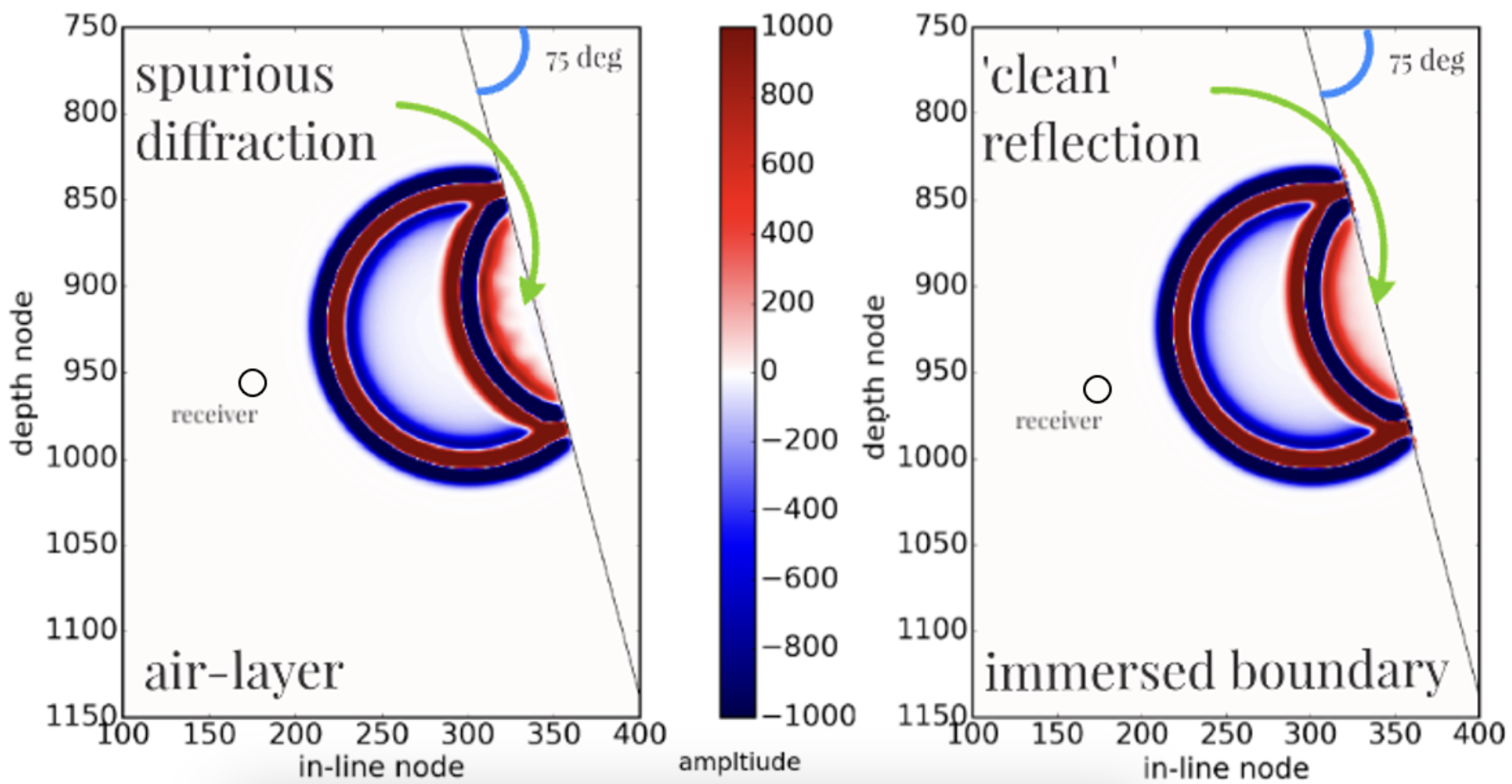
Full-waveform inversion (FWI) is a high-resolution technique of imaging Earth’s interior. An accurate solution of the forward problem is a prerequisite of FWI. As FWI relies on comparing synthetic and observed data wiggle-for-wiggle, the former needs to simulate not less nor more than all physical phenomena recorded in the latter. The latter requirement has to do with e.g. spurious diffraction caused by misalignment of a grid and interface/boundary of a model. A staircase approximation of smooth surface, inherent in the finite-difference (FD) method leads to first-order errors in travel-times, regardless of the accuracy of the scheme used.
To make full-waveform inversion account for complex scattering off the steep Santorini caldera cliffs (which I studied for my PhD), I wrote a Fortran package implementing immersed-boundary method (originated in computational fluid dynamics) and interfaced it with an industry gold standard, MPI-permeated code, launchable on thousands of computing nodes.
The code is available on GitHub and its details can be found in my PhD thesis.1
-
High-resolution imaging beneath the Santorini volcano, Imperial College London doi:10.25560/96427. ↩